
Wheelchair and ADA-Accessible Elopement Locations + Hikes in Washington

If you’re someone who has been dreaming about eloping (or has just learned that eloping is an option nowadays!) but are nervous about being able to find a beautiful location that meets your accessibility needs, this post is for you.
I firmly stand behind the belief that everyone should have access to the outdoors to recreate. Full stop. Whether that’s just to explore somewhere new, to immerse yourself in all nature has to offer, or if you’re planning to elope.
Also, let’s get one thing straight about eloping: You do NOT have to hike to elope! I promise!!
Many couples choose to do a short walk around a beautiful area to take in the scenery without having to strap on hiking boots and get miles and miles away from civilization. There are plenty of locations and trails in Washington that are fairly level and paved or have packed gravel for the majority of the hike. Which means many more folks can access these locations regardless of ability or knowledge about the outdoors!
Tips for Planning an ADA-accessible elopement
Get yourself or your guests an America the Beautiful Access Pass through the National Park Service. This lifetime entrance pass allows you to visit National Parks and other Federal recreation sites for free! The Access Pass is free to anyone with documentation about a permanent disability (read more about required documentation here).
Do thorough research of your elopement location ahead of time and if possible, visit ahead of time so you can confirm for yourselves that it fits you/your guests accessibility needs. When viewing information about a trail, make sure to note elevation gain and elevation loss, if the trail is marked as wheelchair-friendly, and if there are any notes about stairs, steep inclines, and other barriers.
Call a real live park ranger! If you speak with someone that works at the park directly, they’ll be able to give you detailed information about areas and hikes. Plus, they’re kind of the best resource ever.
When booking accommodations for your elopement, chat with your rental hosts about the specifics of accessibility throughout the building(s).

How to find wheelchair-friendly hikes in Washington
Language surrounding accessibility can vary from website to website, and even from author to author. A trail marked ADA-accessible trail could mean that a portion of the trail is wheel-chair friendly, but the rest of the trail is not. Make sure to pay close attention to what each site defines as ADA-accessible, wheelchair friendly, and barrier free.
WTA.org - The Washington Trails Association has thousands of trails across the state with detailed information at the ready. You can filter hikes by “wheelchair-friendly” with a disclaimer about what that means to WTA. Also here’s a great blog about trail wheelchairs!
AllTrails - Another website with endless trails to look through that also includes a “wheelchair-friendly” search filter. This rating is based on trail width, grade, cross-slopes, obstacles, surface firmness and type, and may change throughout the year due to weather.
If you’re someone who prefers a physical guide over a digital resource, I have the perfect book for you: The Disabled Hikers Guide to Western Washington and Oregon. Not only does it offer dozens of hikes to research, it also includes a ton of information about max grades, if the trail is paved or unpaved, Spoon Theory, if dogs are allowed on the trail, and lots more. Seriously, it’s been such an awesome resource for me!
Other Resources to Plan an ADA-Accessible Elopement
Disabled Hikers gets a huge shoutout for their massive collection of knowledge, tips, and information about the accessibility of hiking and recreating outdoors.
Outdoors for All: A non-profit focused on enriching the quality of life for children and adults with disabilities through outdoor recreation. Hell yeah 🤘🏻
National Park Service Accessibility Page has a map of all National Parks that have accessible features.

How to Have an Accessible Elopement While Still having an Adventure
Two options for you:
Choose an ADA-accessible location that you and all of your guests can access. Many of the locations and hikes listed below have very minimal incline, are paved or have packed gravel, with no stairs or other barriers. But believe me, these are NOT your average boardwalks through a boring forest! I’m talking 360-degree views on top of a mountain, locations you can drive right up to, old-growth forests to meander through, and so much more. STILL SO EPIC!
If only your guests have varying abilities, you could choose an ADA-accessible location for your ceremony so they can join and celebrate with you, and then spend another part of your day at a totally different second location.
Olympic National Park and Peninsula Accessible Locations
Olympic National Park is likely the most diverse National Park in Washington where you can hit 3 different types of scenery in a single day or weekend! Cool, right?
Contact info: (360) 565-3130 or send an email
Park accessibility info: https://www.nps.gov/olym/planyourvisit/physical-mobility-accessibility.htm

Moments in Time Interpretive Trail
Trail details: 1.6mi, 25 feet of elevation change
Features (see photo above!): Old growth forest, huge ferns covering the forest floor, views of Lake Crescent, cute little meadow, close access to Lake Crescent Lodge
Accessibility details: Wheelchair-friendly (mostly level and wide), a few spots with 4+ inch roots
Permit required? Yes - groups of more than 5 people need a Special Use Permit, $100. No entrance fee or parking pass.
Notes: There are many spots to have an elopement ceremony with guests along this trail (see photo above!).
Big Creek Campground Trail
Trail details: 1mi loop around Big Creek Campground, minimal elevation change
Features: Views of Big Creek, picnic shelter with tables and stoves available, dense forest
Accessibility details: Mostly flat and even, entire trail is paved
Permit required? Yes, but only a parking pass - Northwest Forest Pass
Bovee’s Meadow
Location details: 0.4mi, minimal elevation change
Features: Canopy trees, old-growth forest, waterfront access, views of Lake Crescent
Accessibility details: From the parking lot there is packed gravel and well-maintained grass
Permit required? Yes - groups of more than 5 people need a Special Use Permit, $100. No entrance fee or parking pass.
Notes: The beach has large rocks not suitable for wheelchairs
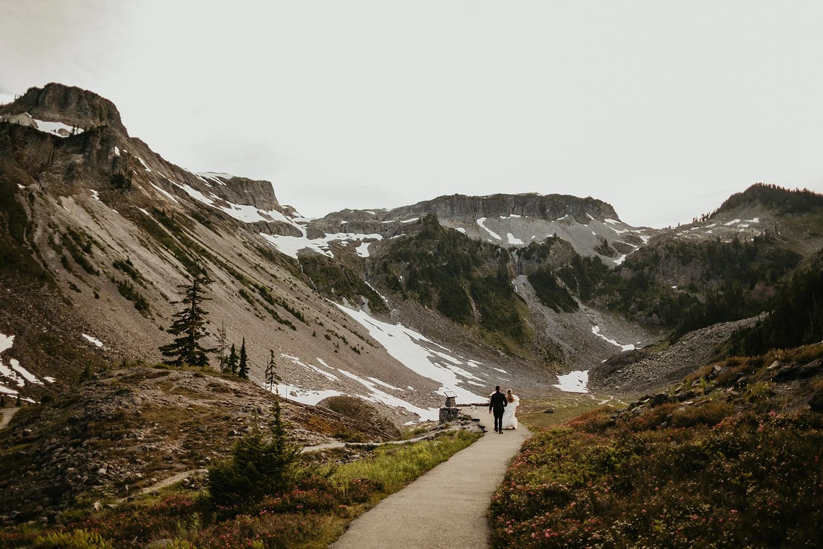
Cirque Rim Nature Trail
Trail details: 0.8 miles, 49 feet of elevation gain
Features: Outstanding views of the Olympic range, wildflowers in the summer, awesome views on the drive up
Accessibility details: The parking lot and trail are paved and smooth, though going beyond 0.4mi may require assistance for wheelchair users as it gets steep in sections
Permit required? Yes groups of more than 5 people need a Special Use Permit, $100. Plus a $30 entrance fee or America the Beautiful Pass.
Notes: You can view most of the trail on Google Street Maps! The visitor center that used to be in this area burned down in 2023 so there are no services whatsoever.
Madison Falls Trail
Trail details: 0.2 miles, 49 feet of elevation gain
Features: A beautiful waterfall!!
Accessibility details: The trail is fully paved, though some roots may make the asphalt a little bumpy.
Permit required? Yes - groups of more than 5 people need a Special Use Permit, $100. No entrance fee or parking pass.
Notes: This area can get pretty busy on weekends and during the day, so plan to be around other folks!
North Cascades Accessible Locations
North Cascades National Park is one of the country’s least visited National Parks, mostly because most of it is so remote! These locations are both in and around the National Park and adjacent National Forests, so contact info may vary between locations.
North Cascades National Park contact info: (360) 854-7200 or send an email
North Cascades National Park accessibility info: https://www.nps.gov/noca/planyourvisit/accessibility.htm
Mount Baker-Snoqualmie National Forest contact info: (360) 856-5700 or email SM.FS.mbs_pao@usda.gov
Okanogan-Wenatchee National Forest contact info: (509) 996-4000
Picture Lake Trail
Trail details: 0.4 miles, minimal elevation change
Features: A short path to stunning views of Picture Lake, and on a clear day, views of Mount Shuksan and the North Cascades! Wildflowers grow in the summer, too.
Accessibility details: The trail features a boardwalk and packed gravel, though some parts may have overgrown roots or shrubs. There are also 2 wheelchair accessible docks.
Permit required? Yes, but only a parking pass - Northwest Forest Pass
Agency: Mount Baker-Snoqualmie NF
Notes: This area is covered in snow from about October to July every year, so check conditions before heading up.

Fire and Ice Trail
Trail details: 0.6 mile loop, 62 feet of elevation gain
Features (see photo above!): Incredible mountain/valley/lake views, wildflowers, and a visitor center
Accessibility details: Go counterclockwise from the parking lot! It’s paved, even, and leads you to a great overlook (that’s perfect for an elopement ceremony 😉). The rest of the trail is fairly narrow, dirt, and has some steep grade and steps.
Permit required? Yes, but only a parking pass - Northwest Forest Pass
Agency: Mount Baker-Snoqualmie NF
Notes: This area is covered in snow from about October to July every year, so check conditions before heading up.

Artist Point
Location details: A short walk starting at the Artist Point parking lot, this trail is part of the trail to Huntoon Point. My best estimate is about 0.2 miles of path is paved, a moderate grade, and ready to explore!
Features (see photo above!): Jaw-dropping mountain views of Mount Baker and Mount Shuksan, plus wildflowers galore.
Accessibility details: From the parking lot, start your hike on the paved path and you’ll come across a viewpoint up a small hill (incredible spot for an elopement ceremony!), plus additional viewpoints along the trail that face South.
Permit required? Yes, but only a parking pass - Northwest Forest Pass
Agency: Mount Baker-Snoqualmie NF
Notes: This area is covered in snow from about October to July every year and the final 1.8 miles of the road is closed during those months, so check conditions before heading up.
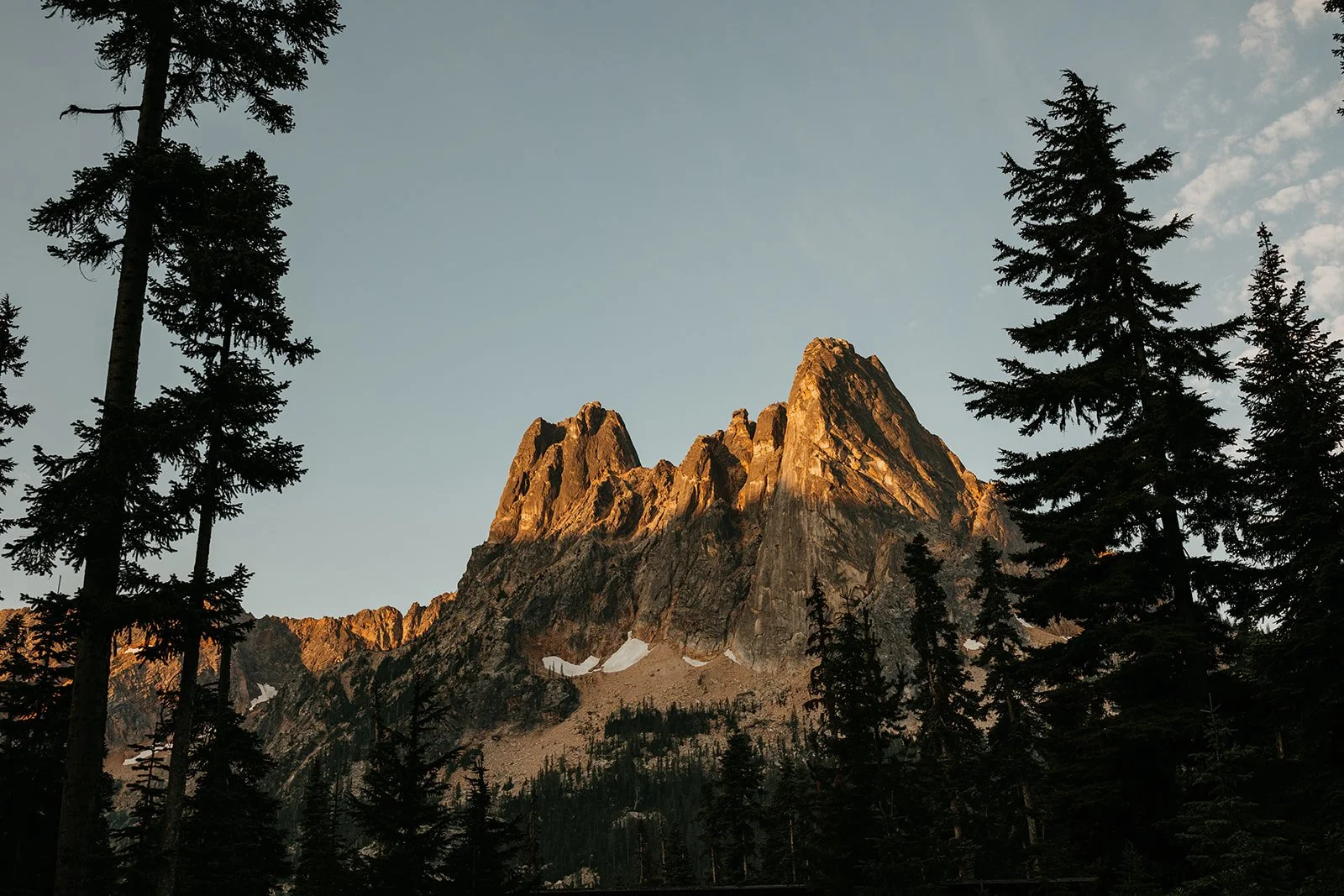
Washington Pass Overlook Trail
Trail details: 0.3 miles, 61 feet of elevation change
Features (see photo above!): Awesome views of the North Cascade Range, a giant valley below, and in October, larch trees for miles!
Accessibility details: Start this hike going counterclockwise (towards Washington Pass Vista Point) - the path is paved but can be a little steep in places. You’ll quickly reach a viewpoint with a railing that has great views. To access the rest of the trail, you’ll need to head back to the trailhead and hike clockwise ~0.1 miles to get to another viewpoint. Unfortunately there are stairs between the two viewpoints, so completing the loop may not be feasible.
Permit required? Yes - A commercial photography permit is required to take photos at any wedding. Can range from $134 to $479, depending on group size. No parking pass required.
Agency: Okanogan-Wenatchee NF
Notes: Highway 20 is completely closed every year from about November to May due to heavy snow, making this location completely inaccessible. Check conditions before heading up!
Trail of the Cedars
Trail details: 0.9 miles, 49 feet of elevation gain
Features: Evergreen forests, views of the Skagit River, and a boardwalk bridge over the Skagit River (it’s super cool!!)
Accessibility details: Most of the trail is packed gravel and can range in width, but the first stretch is paved with a bridge over the Skagit River.
Permit required? Yes - Special Use Permit is required for all weddings, $50. No parking pass required.
Agency - North Cascades National Park
Notes: While this location is open year-round, the road beyond it, Highway 20, closes every year from about November to May due to heavy snow. Check conditions before heading up!
Happy Creek Forest Walk
Trail details: While the entire trail is longer and not fully accessible, the first 0.3 miles are wheelchair-friendly and has minimal elevation change
Features: Boardwalk through old-growth forest
Accessibility details: The initial loop of the longer Happy Creek Nature Trail is mostly boardwalk and is very wheelchair accessible.
Yes - Special Use Permit is required for all weddings, $50. No parking pass required.
Agency - North Cascades National Park
Notes: Highway 20 is completely closed every year from about November to May due to heavy snow, making this location completely inaccessible. Check conditions before heading up!
Mount Rainier National Park Accessible Locations
Mount Rainier is the highest point in the lower 48 states, sitting at 14,408 feet. She’s iconic, she’s covered in glaciers and snow, and she has a ton of recreation opportunities year-round.
Contact info: (360) 565-3130 or send an email
Park accessibility info: https://www.nps.gov/mora/planyourvisit/accessibility.htm
Things to note:
Most of the park is closed from late Fall until late Spring, as it gets a ton of snow! The Paradise area is open most days in the winter, but can close due to weather or staffing issues.
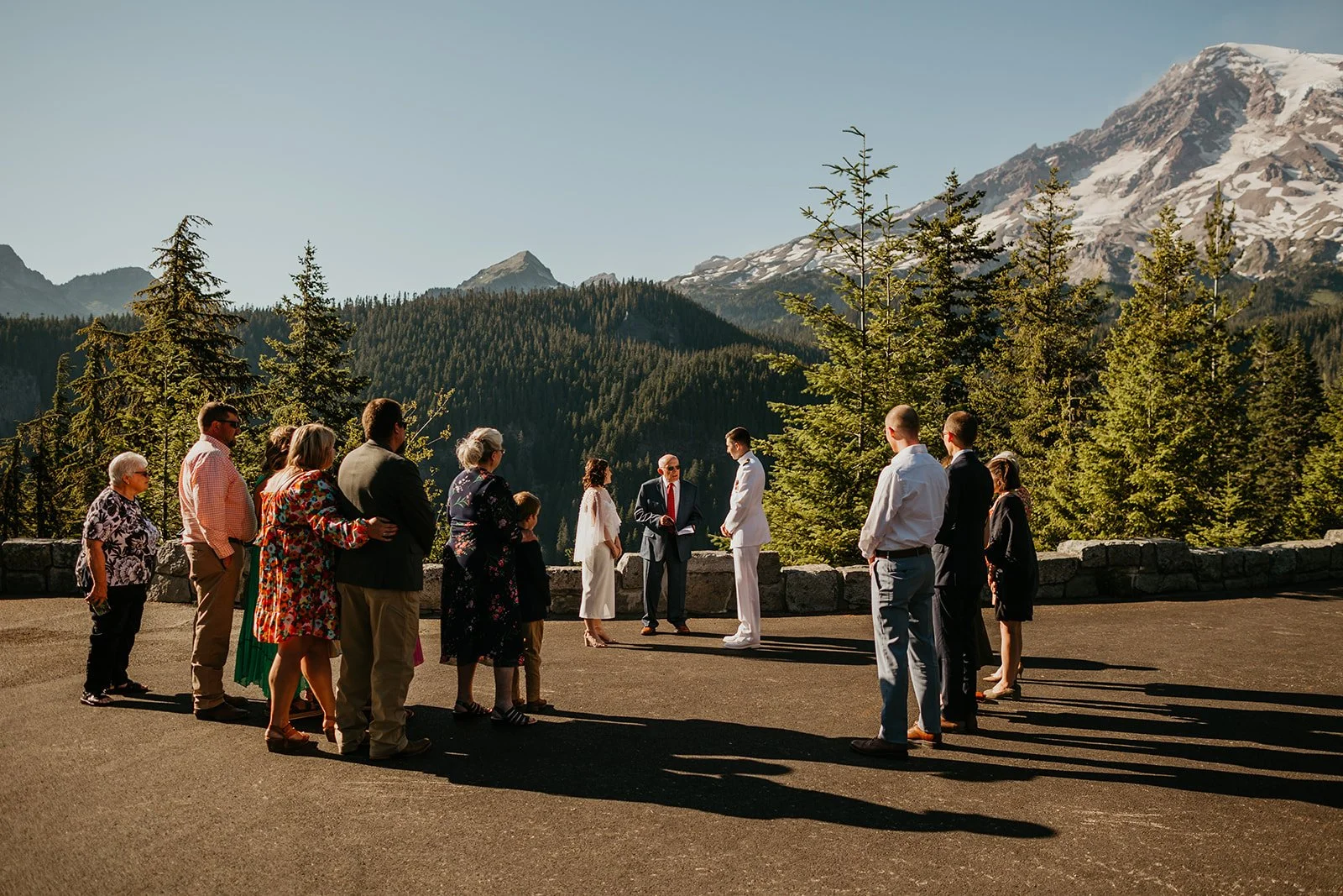
Ricksecker Point
Location details: A short road off of the main road to Paradise has a viewpoint that is great for a small ceremony! While there can be quite a few people coming and going in their cars, it’s still a great place to experience the park without going far.
Features (see photo above!): Wide open views of Mount Rainier, valley views of the Nisqually River
Accessibility details: The parking lot is entirely paved and has a short wall at the edge. There aren’t many designated parking spots but lots of room for cars and people.
Permit required? Yes - Mount Rainier National Park requires a Special Use Permit for all weddings, and has strict limitations on group sizes and times/days permits will be issued. The application fee is $25 and the Special Use Permit is $250. Plus a $30 entrance fee or America the Beautiful Pass.
Notes: Plan for a sunrise or sunset elopement ceremony for the fewest passersby!

Sunrise Picnic Area
Location details: A cute picnic spot encircled by a paved and/or packed gravel road, making it easy to get to for everyone
Features (see photo above!): Picnic tables, amazing Mount Rainier views, and wildflowers
Accessibility details: From the parking lot, the path is paved and level, eventually turning to a packed gravel road (that is only for park employees)
Permit required? Yes - Mount Rainier National Park requires a Special Use Permit for all weddings, and has strict limitations on group sizes and times/days permits will be issued. The application fee is $25 and the Special Use Permit is $250. Plus a $30 entrance fee or America the Beautiful Pass.
Notes: The Sunrise area is only accessible from about July to October, as it gets buried in snow for the rest of the year! The picnic tables are scattered around the area, but some are not wheelchair accessible. See a Photosphere here and more information about the picnic area here.
Nisqually Vista Loop
Trail details: 1.1 mile loop, 180 feet of elevation gain (plus additional distance for wheelchair accessibility, see notes)
Features: Incredible views of Mount Rainier, the Nisqually Glacier, and dense forest
Accessibility details: While the entire loop itself is paved, the Nisqually Vista trailhead has a set of stairs. But not to worry, you can access it from a different trailhead! Start at the Henry M. Jackson Visitor Center, make your way up the paved ramp to the right, and follow the Avalanche Lily trailhead for about 0.2 miles. You’ll come across a left turn to Deadhorse Creek Trail where you will travel about 0.1 miles and you’ll find yourself at the Nisqually Vista trailhead, just at the top of the stairs.
Permit required? Yes - Mount Rainier National Park requires a Special Use Permit for all weddings, and has strict limitations on group sizes and times/days permits will be issued. The application fee is $25 and the Special Use Permit is $250. Plus a $30 entrance fee or America the Beautiful Pass.
Notes: More information about the trail here and you can see a walkthrough on Google Street Map of the Nisqually Vista Loop here.
Bonus Mount Rainier location! Keep scrolling to read about Red Top Lookout, where you can get incredible views of Mount Rainier without even being in the park.
Central Cascades Accessible Locations
The Central Cascadse are not to be overlooked even though the area can fly under the radar when up against the National Parks. Tons of hidden gems and less popularity at many locations and trails!
Mount Baker-Snoqualmie National Forest contact info: (360) 856-5700 or email SM.FS.mbs_pao@usda.gov
Things to note:
Most locations in the Central Cascades are managed by Mount Baker-Snoqualmie National Forest, but some other Wilderness Areas, National Forests, and other public lands may manage the lands as well.

Gold Creek Pond Loop
**IMPORTANT INFO: This trail will be closing in the Spring of 2025 for restoration and could remain closed for up to 10 years.
Trail details: 1.2 miles, 45 feet of elevation gain
Features (see photo above!): Pond access and views, mountain views, and evergreen forests
Accessibility details: The trail is paved and has a couple of wooden boardwalks to cross. There are a few spots where roots have grown under the path, making it uneven and potentially difficult to pass.
Permit required? No
Notes: You don’t even have to do the whole loop to get those epic mountain views! Once you hit the trail, you’ll reach the pond in about 0.2 miles.
Sun Top Lookout
Location details: While there is a hike you can do to get to this lookout, on days when the lookout is in service you are able to drive right up to the lookout!
Features: 360-degree views of the Central Cascades (including Mount Rainier!) and a wheelchair-accessible fire lookout
Accessibility details: You can park right near the lookout and take the short but packed gravel trail up to the lookout ramp. Once you’re on the lookout deck that surrounds the entire lookout (that’s 5 feet wide, by the way!), park rangers or volunteers may allow you to enter the lookout itself as there is a window that has door hinges that make it wheelchair accessible!!
Permit required? Yes - A commercial photography permit is required to take photos at any wedding. Can range from $134 to $479, depending on group size. No parking pass required.
Agency: Okanogan-Wenatchee NF
Notes: You might find photos around that are from the old Sun Top Lookout, that was deconstructed and rebuilt. I learned that it was specifically rebuilt to make it ADA-accessible!
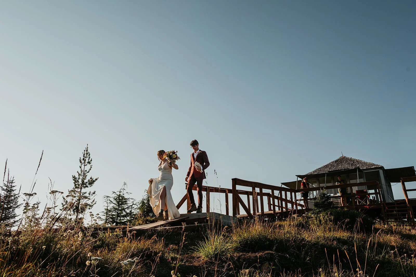
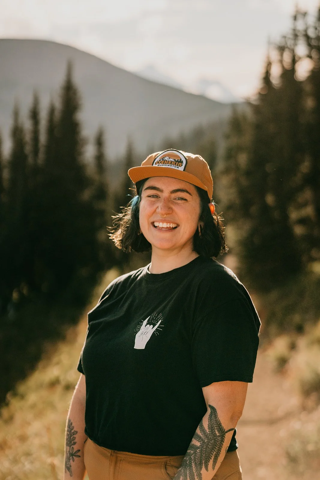
Book your elopement photographer!
If you’re looking for the most incredible elopement experience, look no further! I’m Van and I think you’re going to love what we can create together.
Washington elopement packages start at $5,700
And include the following:
A minimum of 4 hours of elopement photography coverage
Travel to ANYWHERE in Washington
Unlimited support (both knowledge and moral!)
Access to my library of resources on how to elope
Detailed and custom location suggestions based on your needs
Elopement day timeline creation
Recommendations for outstanding vendors
High-resolution files that are yours to keep
Complimentary officiating services